![]() Marriage certificate of George Jones and Harriet Flight
Marriage certificate of George Jones and Harriet Flight
![]() Marriage certificate of George Jones and Harriet Flight (PDF)
Marriage certificate of George Jones and Harriet Flight (PDF)
![]() 1851-1881 Census information for George Jones (PDF)
1851-1881 Census information for George Jones (PDF)
![]() Birth certificate for William Scott Jones (PDF)
Birth certificate for William Scott Jones (PDF)

Aerial photograph of the town centre, Stourbridge, from the south-east,
9 June 1938 (Britain from Above)

Aerial photograph of the town around the junction of High Street and
New Road, Stourbridge, 1938 (Britain from Above)

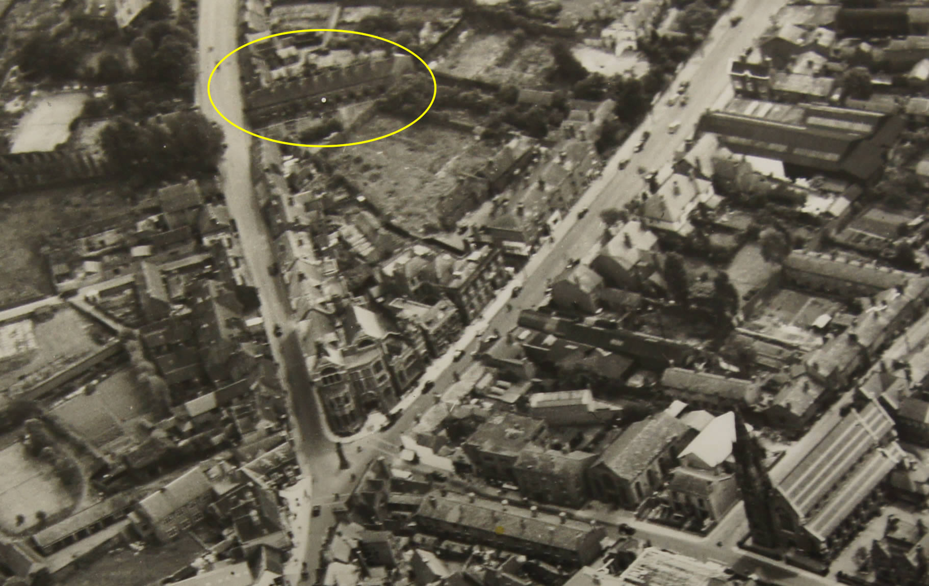
Copenhagen Row, Stourbridge, 1938 (Copyright English Heritage)

Aerial photograph of Church Street, Stourbridge, 2011 (from Dudley Archives website)

Church Street, Stourbridge, 2013

Stourbridge, 1838
Street Names of Stourbridge by H Jack Haden
COPENHAGEN PLACE, a row of cottages shown on the 1837 map
extending S.W. from Windmill Street (Church Street), Stourbridge,
and also on the 1881/2, 1921 and 1948 O.S. maps,
but they were demolished about 1948 and the site and some
additional land was opened in April 1949 as a public car
park for 100 cars. Major George Harry Green, J.P., of
Oakleigh, Oldswinford, a director of Eliza Tinsley and Co.,
nail, rivet and chain manufacturers of Old Hill gave £500
towards the cost of the project - the town's first public
car park. Copenhagen Place was probably named after the
Battle of Copenhagen on 2 April 1801, the action when Vice-admiral
Horatio Nelson put his telescope to his blind eye
and said he could not see the signal from his commander-in-
chief Sir Hyde Parker to discontinue the action against
the Danish fleet.
CHURCH STREET, Stourbridge, extending from the junction of High Street with Hagley Road to where Red Hill is entered by Junction Road (formerly Halfpenny Hall Lane) is an ancient road providing a direct route from Stourbridge town to Oldswinford parish church. On the 1837 map it is named Windmill Street, as a windmill stood on the summit of the hill at the rear of a block of flats south of Ibstock Drive.
WINDMILL STREET, Stourbridge, is the name given on the 1837 Stourbridge plan to the length of road from the south end of High Street to the top of the hill where Halfpenny Hall Lane (Junction Road) joins Red Hill. It is named on the 1847 map, but the windmill is not marked, although it is on the 1837 map, and presumably the street was renamed Church Street in the second half of the 19th century - probably when St. John's Church was built in 1861 on a site between Foster Street and the length of Parkfield Road that extends north-east from Church Street. The windmill is shown on an engraved view of Stourbridge in the late 18th century that is to be found in copies of Nash's "Worcestershire".